

September 2, 2026
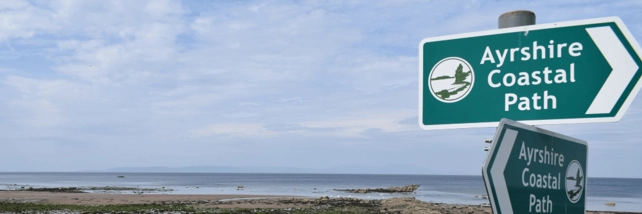

Beachcomber is a regular walker and writes about the Ayrshire Coastal Path
Beachcomber loves to hug the county shoreline as he moves north. Keep the wet stuff on the left, keep the dry stuff on the right. Keep that prevailing southwest wind on your back hurrying you along. That’s what Grandpa Beachcomber grumbled as he cut another twist of tobacco and cranked up the Austin A90.
The best route is via the Ayrshire Coastal Path. It’s a 106 mile trail that’s been carved out of the curving and rolling landscape overlooking the Clyde. It’d been created by hard work, millions of days of negotiation and successfully engineering a way to relish this fine old marriage of land and sea.
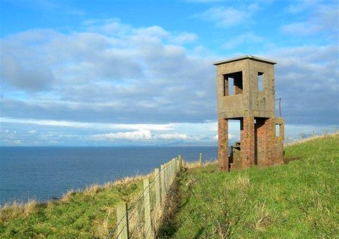
One of the most glorious stretches is from Turnberry to Dunure, an eight mile trek that can be shortened at any point. It takes in the famous hotel’s lighthouse, Maidens beach, the wonders of Culzean, Croy shore (strangely nicknamed Maybole shore) and this beauty, which happens to be Beachcomber’s favourite spot for lunch:
The whole of the path is nursed along by the selfless effort from volunteer Ayrshire Coastal Path squads that endure all kinds of weather to keep it in shape. Below, a team repairing the steep Fisherton Gully steps just north of Dunure:
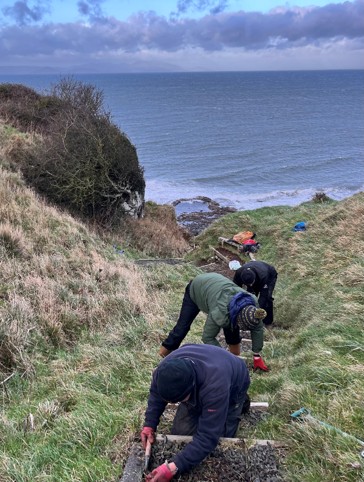
It has to be done. If not, the route would crumble through wind, rain and the unending onslaught of boots and wellies.
In the summer, the work concentrates on relentlessly strimming back tall grass and bracken that overwhelm the trails. Winter work includes replacing stiles, gates and rotting steps. Urgent work always takes top priority if safety is an issue - whatever the season.
The overseer of this work is Jimmy Begg, a retired Ayrshire GP, who tirelessly ensures that his dream of a shoreline path remains a reality. He’s the trail manager, the originator of the path, the guidebook author, the crew boss of the volunteer work crews and the living spirit of this long distance route.
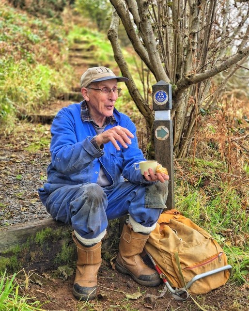
In a recent website interview, he explains the route survives ‘…on trust, goodwill and working with landowners, the farmers and councils.’
And crucially he adds ‘…there wouldn’t be a coastal path without the volunteers.’
Dr Begg, or Jimmy to one and all, came up with the notion of the trail in 2004 as part of a Rotary campaign. It was initially going to be a hook-up between Ayr and Culzean. But Jimmy saw the Big Picture and eventually battled to connect Glen App, south of Ballantrae, to Skelmorlie in the north - 106 miles of guaranteed pleasure.
The goals, Jimmy says, are to both improve the Ayrshire economy and the health of those who enjoy a trek. In addition, there’s muscles to be stretched and loads of fresh air to maintain the route, whether it be fixing fences, erecting signs, cutting back bracken or doing heavy lifting such as bridge building or erecting gates.
All to connect beaches, promontories, headlands, coves, farm tracks, promenades, estate roads, stalking paths, cliffs, villages,harbours and isolated country lanes…..
‘ You name it.’ says the good doctor, ‘we walk it.’
Photo credit of Dr Begg/Martin McKerrell

